-

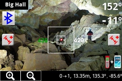
Pointing the camera at one point and measure, the application will indicate the direction and inclination. Aragonite Cave Compass is a tool intended to serve us...
ARAGONITE CAVE COMPASS

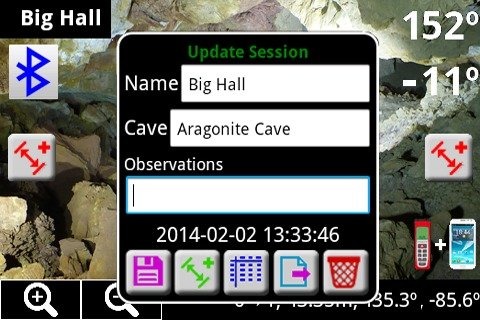
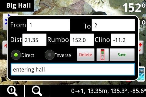
Pointing the camera at one point and measure, the application will indicate the direction and inclination. Aragonite Cave Compass is a tool intended to serve useful to cavers in cave mapping. Aragonite Cave Compass replaces the typical compass and inclinometer used in conventional underground topography. Aragonite Cave Compass provides compass and inclinometer measures using Android device magnetic sensors, allowing add the distance measurement and keeping all information on measurement sessions. The measurements data Session can then be download to a PC for use with applications that caver desease.- Compatible with DistoX: save measurements trough Bluetooth from DistoX telemeter. More an accurate info in paperless.bheeb.ch- Inclinometer calibrating: Improved clino readings factory compensating error- 3 measuring modes: measuring with the device itself, measuring with DistoX telemeter and Bluetooth, mixed measuring (combination of the above two) - Multiple measurement sessions- Measurements edition- Export sessions measures to text files and Visual Topo files.- Measuring shot by proximity sensor- Zoom
ARAGONITE CAVE COMPASS游戏截图

本周飙升榜


新游期待榜
热门推荐


相关专题
最新专题
- 友情链接
- 最新游戏

 粤公网安备44010602000283号

玩家评论
更多>>全部评论